

Quick answer
The christchurch to arthurs pass drive covers 152 kilometres via State Highway 73 and takes approximately two hours without stops. Most travellers allow three to four hours to account for photo stops at Castle Hill, Porter's Pass, and the Waimakariri Gorge. Road conditions vary with altitude—expect alpine weather above 900 metres and potential snow or ice from May to October.
State Highway 73 is the only sealed route connecting Christchurch to Arthur's Pass, and it remains one of New Zealand's most dramatic elevation gains over such a short distance. The highway departs the city through flat pastoral land, crosses the braided Waimakariri River, then begins its steady climb through tussock basins and limestone outcrops before entering the alpine zone of Arthur's Pass National Park. The road crosses three distinct climate zones. The first 60 kilometres traverse the Canterbury Plains with wide visibility and minimal elevation change. Beyond Porters Pass, the highway enters montane terrain where weather can shift rapidly—clear mornings frequently give way to afternoon cloud or rain as moist westerlies collide with the main divide. The final 30 kilometres thread through the Waimakariri Gorge, a steep-walled valley where the road clings to the riverbank and tunnels through bedrock in several places. Snow chains are mandatory during winter advisories, and the Department of Conservation updates road status daily during storm events. Castle Hill, 90 kilometres west of Christchurch, is the most-photographed waypoint on the christchurch to arthurs pass drive. The limestone boulders—some exceeding five metres in height—sit scattered across open tussock and have been used as a filming location for international productions. A short walking loop circles the main boulder field and adds 20 minutes to the journey. Porters Pass, at 945 metres, marks the transition into alpine conditions; a small ski area operates here in winter. The Bealey Hotel, 10 kilometres before Arthur's Pass village, serves as the last reliable fuel and food stop before the township. Arthur's Pass village sits at 740 metres elevation and functions as the operational hub for the national park. The Department of Conservation Visitor Centre opens daily from 08:30 to 16:30 and provides current track conditions, weather forecasts, and avalanche bulletins. Rangers recommend arriving between late morning and mid-afternoon to allow time for consultation before attempting day walks such as Avalanche Peak or the Devil's Punchbowl. The TranzAlpine train crosses the Southern Alps on the same route, offering an alternative for those who prefer not to drive the alpine section in winter.
“The highway crosses three distinct climate zones, and weather above 900 metres can shift from clear to storm conditions within an hour.”
Planning Your Christchurch to Arthurs Pass Drive
This itinerary suits independent travelers departing Christchurch in the morning and returning by evening. The full journey spans approximately 8–9 hours, balancing 3 hours of driving with flexible stops for short walks and scenery.
Depart Christchurch
Leave the city via SH73, driving west through Canterbury Plains. Allow 90 minutes to reach Castle Hill without stops.
Castle Hill Basin
Stop for 30–45 minutes to walk among the limestone boulders. Popular with climbers; parking is roadside and limited.
Arthur's Pass Village
Arrive at the village (104 West Coast Road) and visit the DOC Visitor Centre to check current track conditions and weather. Allocate 20 minutes.
Devil's Punchbowl Walk
Complete the 1-hour return walk to the 131-meter waterfall. The track climbs through beech forest; wear sturdy footwear.
Lunch Break
Eat at the village café or use the picnic area near the visitor centre. Allow 45 minutes before resuming exploration.
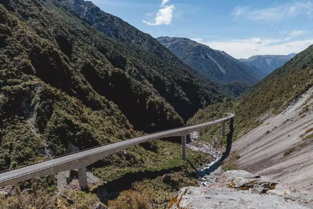
Otira Viaduct Lookout
Drive 15 minutes west to the lookout for views of the historic viaduct and Otira Valley. Quick 10-minute photo stop.
Begin Return Journey
Start the 2-hour drive back to Christchurch via SH73, retracing the route through the alpine passes and plains.
Navigating the Christchurch to Arthurs Pass Drive
The drive from Christchurch to Arthur's Pass follows State Highway 73, a well-maintained route crossing the Southern Alps. This road connects the Canterbury Plains directly to the Arthur's Pass National Park village.
State Highway 73 via Darfield and Springfield
InterCity service to Arthur's Pass
TranzAlpine line from Christchurch Railway Station
The Best Time for Your Christchurch to Arthurs Pass Drive
The optimal period to drive from Christchurch to Arthur's Pass is during the shoulder seasons of autumn and spring, specifically arriving within the best arrival window of 08:30–15:00. This timing balances manageable weather conditions with reduced visitor volume.
Summer (Dec–Feb)
High; peak tourist seasonWarm, 15°C to 22°C; stable conditions
Expect heavy traffic and higher demand for services. Plan for early departures to secure parking.
Autumn (Mar–May)
Moderate; quieter than summerMild, 8°C to 16°C; crisp air
Stable weather makes this an ideal time for hiking. Colors in the beech forests change.
Winter (Jun–Aug)
Low; skiers visitCold, 0°C to 8°C; snow likely
Expect potential road closures due to ice or snow. Carry chains and check local reports.
Weekday mornings
Low; ideal for solitude—
Arriving between 08:30–15:00 avoids midday crowds and allows sufficient time to consult rangers for current track and weather conditions.
Verdict: The best time for your drive is a weekday during April or October, ensuring you arrive within the 08:30–15:00 window to consult rangers and avoid congestion.
Operating Hours for the Christchurch to Arthurs Pass Drive Arrival
The Arthur's Pass National Park Visitor Centre is open daily to provide information and assistance for your journey.
| Monday | 08:30–16:30 | |
|---|---|---|
| Tuesday | 08:30–16:30 | |
| Wednesday | 08:30–16:30 | |
| Thursday | 08:30–16:30 | |
| Friday | 08:30–16:30 | |
| Saturday | 08:30–16:30 | |
| Sunday | 08:30–16:30 |
Must-See Stops on the Christchurch to Arthurs Pass Drive
The journey between Christchurch and Arthur's Pass features diverse landscapes ranging from the Canterbury Plains to the dramatic Southern Alps. These stops highlight the geological and historical significance of the route.
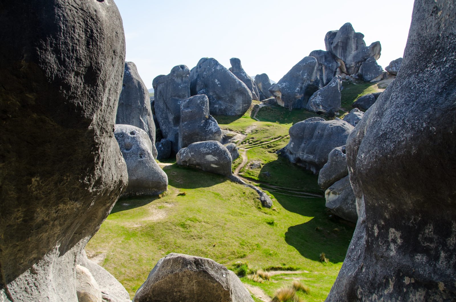
Castle Hill / Kura Tawhiti
A site of large limestone rock formations held in high regard by Ngāi Tahu. Visitors can walk among these boulders on a short track.
Walk the perimeter early to capture the boulders without crowds.
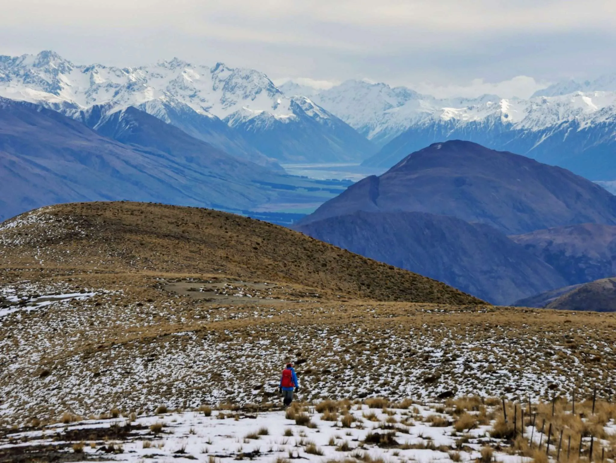
Korowai-Torlesse Tussocklands Park
A vast area featuring expansive tussock grasslands and mountain vistas. It serves as a transition zone between the plains and the high alpine environment.
Stop at designated pull-offs to photograph the mountain range.
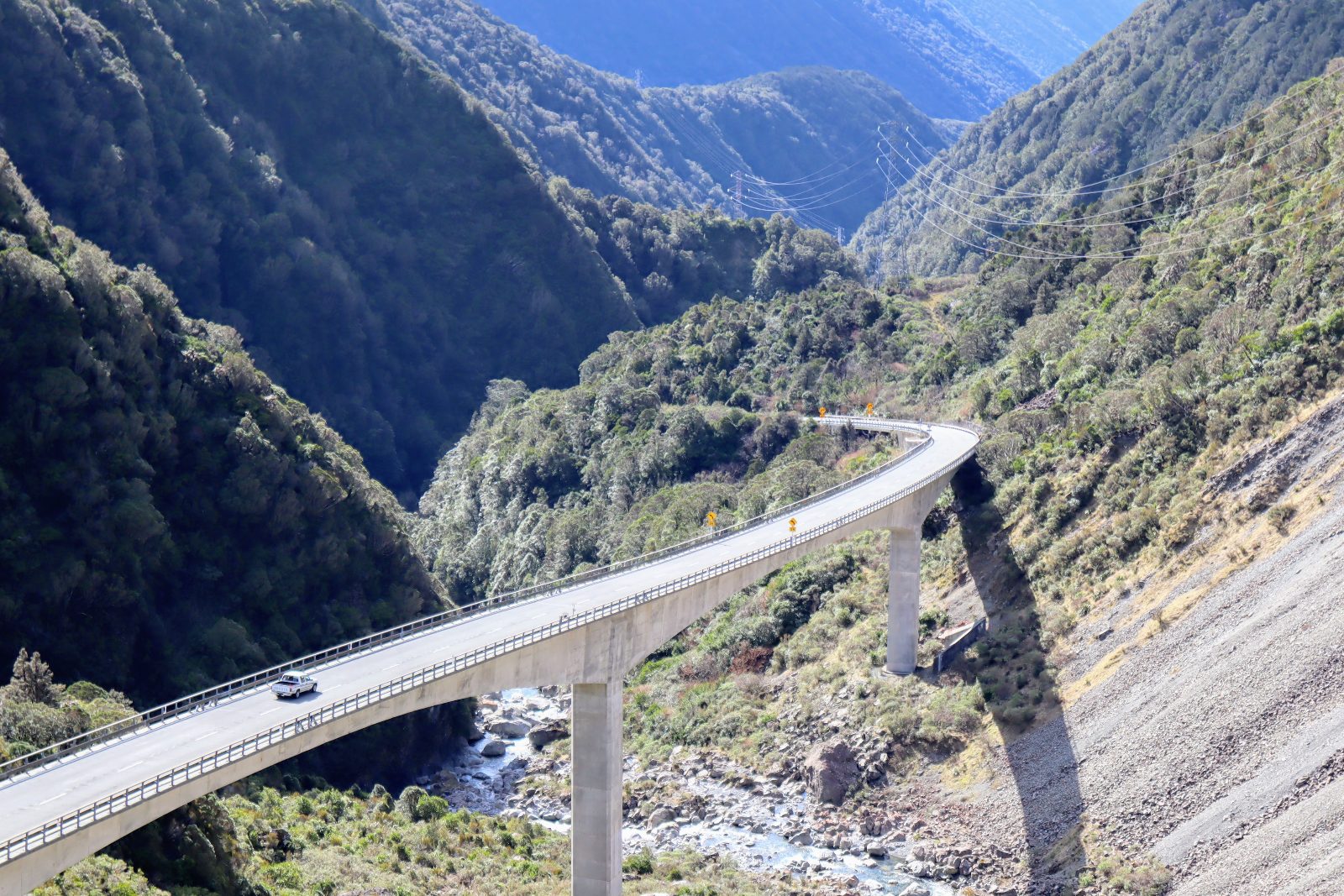
Otira Viaduct
A significant engineering structure spanning the Otira Gorge. It provides a unique perspective of the rugged mountainous terrain.
View from the dedicated lookout point at the top.
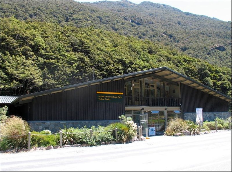
Arthur's Pass National Park Visitor Centre
The primary hub for information regarding the national park, located at 104 West Coast Road. Rangers provide data on track conditions and local flora.
Consult rangers here before starting any regional hikes.
Check availability
Frequently Asked Questions About the Christchurch to Arthurs Pass Drive
Everything you need to know about christchurch to arthurs pass drive